Atlas Maps
Gallery and technical index of the UCSB geospatial map plates
The atlas consists of 12 planned plates and analytical workflows covering raster processing, vector overlays, projection conversions, multi-band remote sensing, and composite cartographic layouts.
Plates Index
| Plate | Title | Key Geospatial Concepts & Data Layers | Status |
|---|---|---|---|
| Map 1 | Campus Overview | Topo-bathymetric raster merging, hillshade, bikeways, campus & Isla Vista buildings | Complete |
| Map 2 | Thematic Trees & Water | Classified tree inventory by type, stream networks, prominent legend, clean axes | Complete |
| Map 3 | Western US Locator | Continental elevation model, whole degree graticule, populated places layer | Complete |
| Map 4 | The Bight of California | Sub-regional Southern California Bight, ocean hillshade, campus locator box | Complete |
| Map 5 | Extended Campus | Greater campus DEM, batho-topo, hillshade, clean legendless presentation | Complete |
| Map 6 | UCSB Main Campus | Focused base map of main campus using Map 1 visualization | Complete |
| Map 7 | Atlas Page Layout | Multi-panel layout combining Maps 3, 4, 5 & 6 using magick |
Complete |
| Map 8 | Satellite Remote Sensing | PlanetScope 4-band / 8-band multispectral seasonal imagery | Complete |
| Map 9 | Vernal Pools (DEM) | Landscape depression analysis using elevation neighbors | In Design |
| Map 10 | Bike Paths & Creeks | Vector intersection analysis (terra::intersect) of trails and waterways |
Complete |
| Map 10.5 | Missing NCOS Trail | Data provenance analysis of post-2018 NCOS trail & bridge omission | Complete |
| Map 11 | Spliced Dibblee Geology | Splicing adjacent sheets (Dos Pueblos Canyon & Goleta) across the campus AOI | Complete |
| Map 12 | 12-Month NDVI Stack | Multi-temporal raster stack, NDVI calculation, vegetation phenology curve | Complete |
Featured Plates
Map 1: Campus Overview
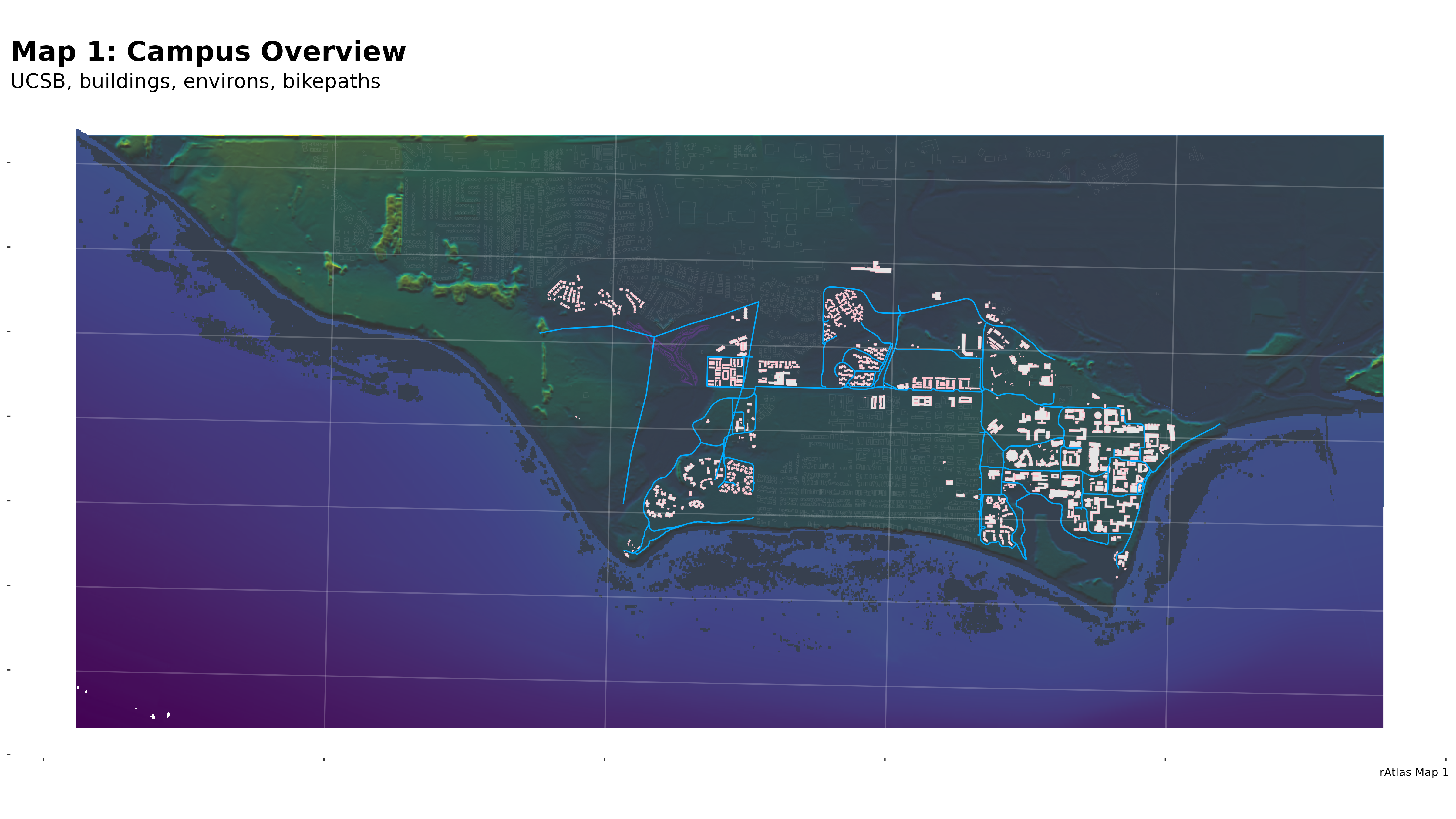
Elevation, bathymetry, hillshade, and campus infrastructure.
Map 2: Trees & Water
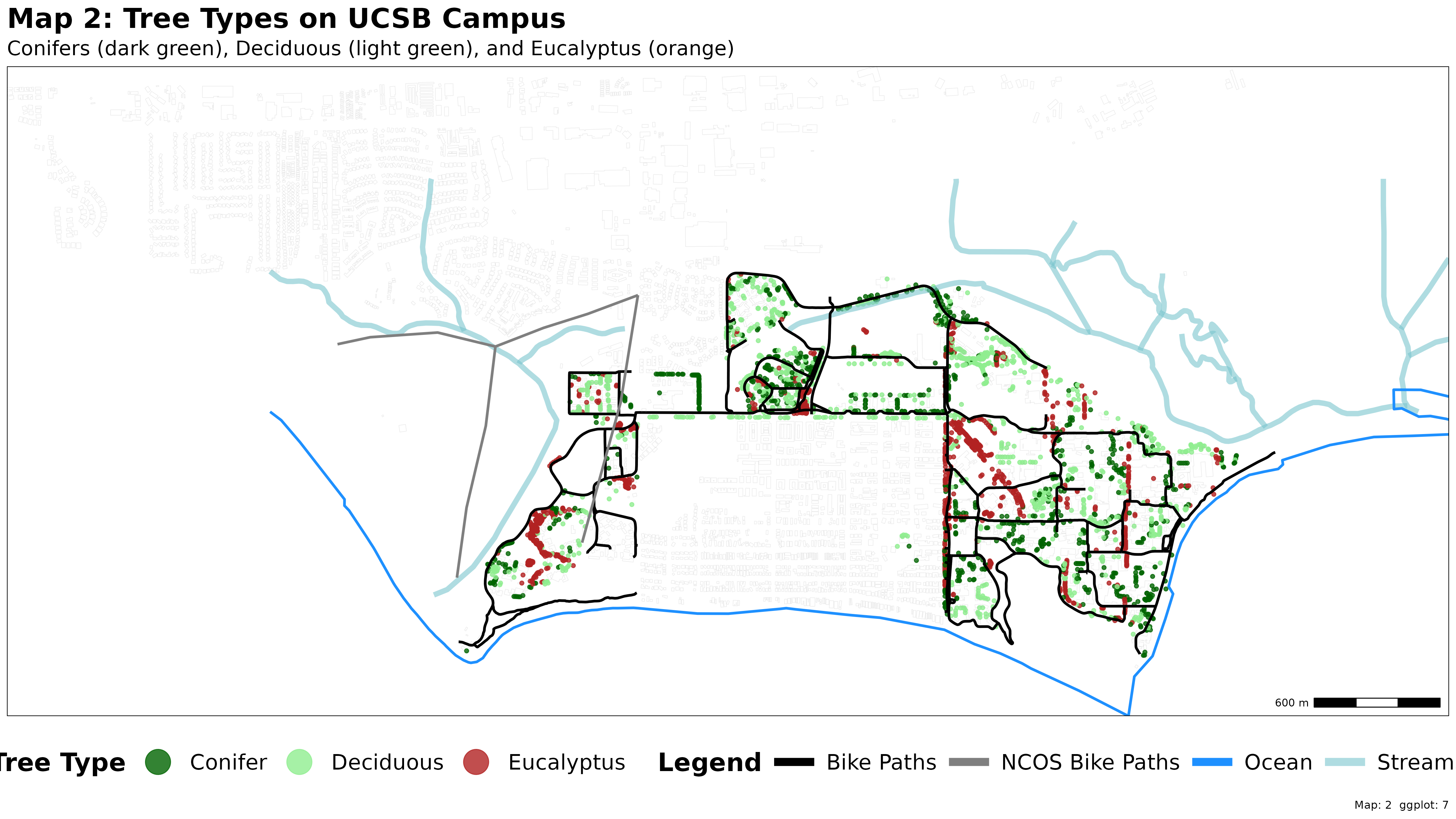
Stylized tree species and heights along coastal slough waters.
Map 7: Composite Atlas Plate
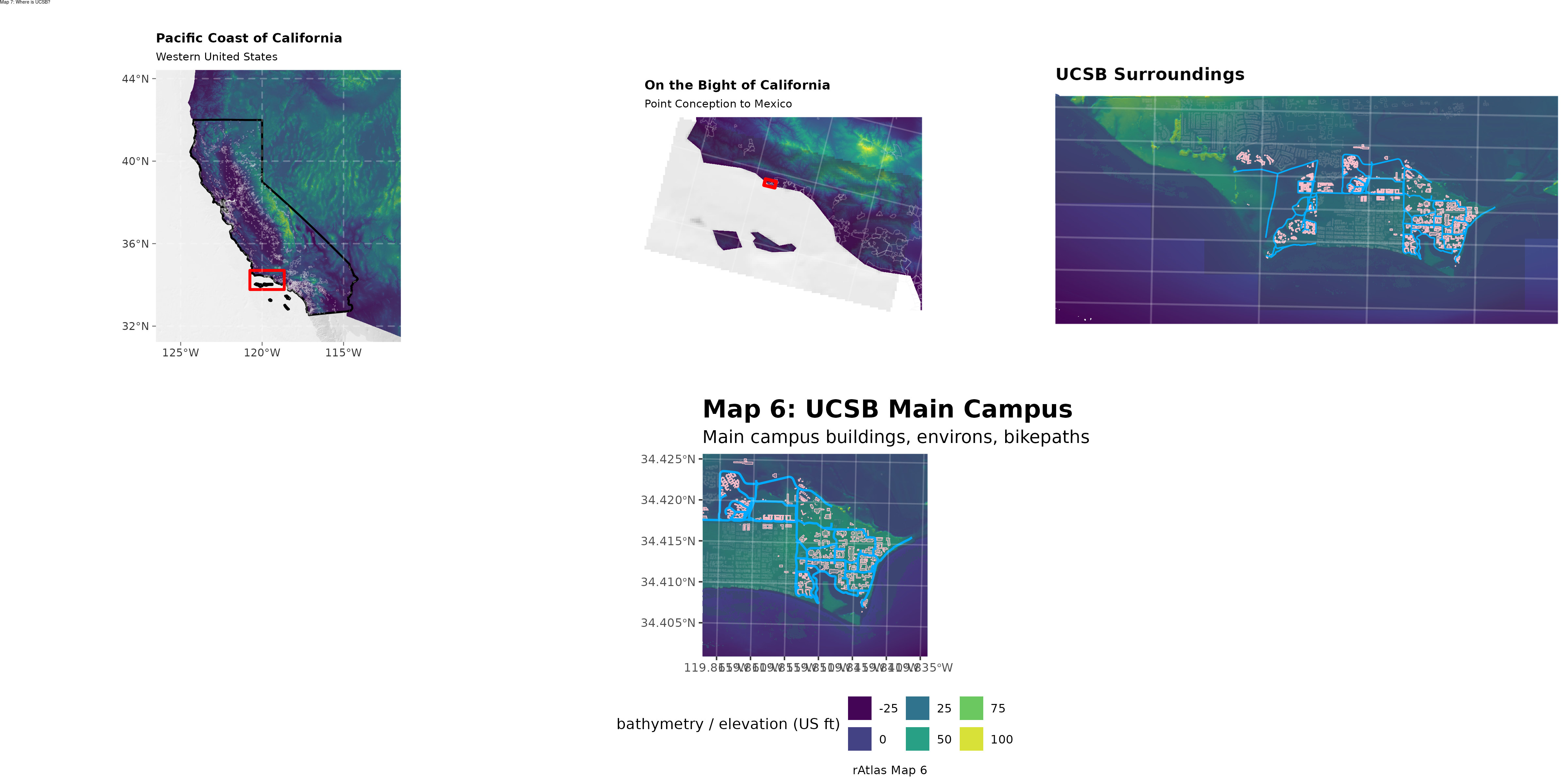
4-inset layout showcasing progressive geographic scale.
Map 10: Paths & Creeks
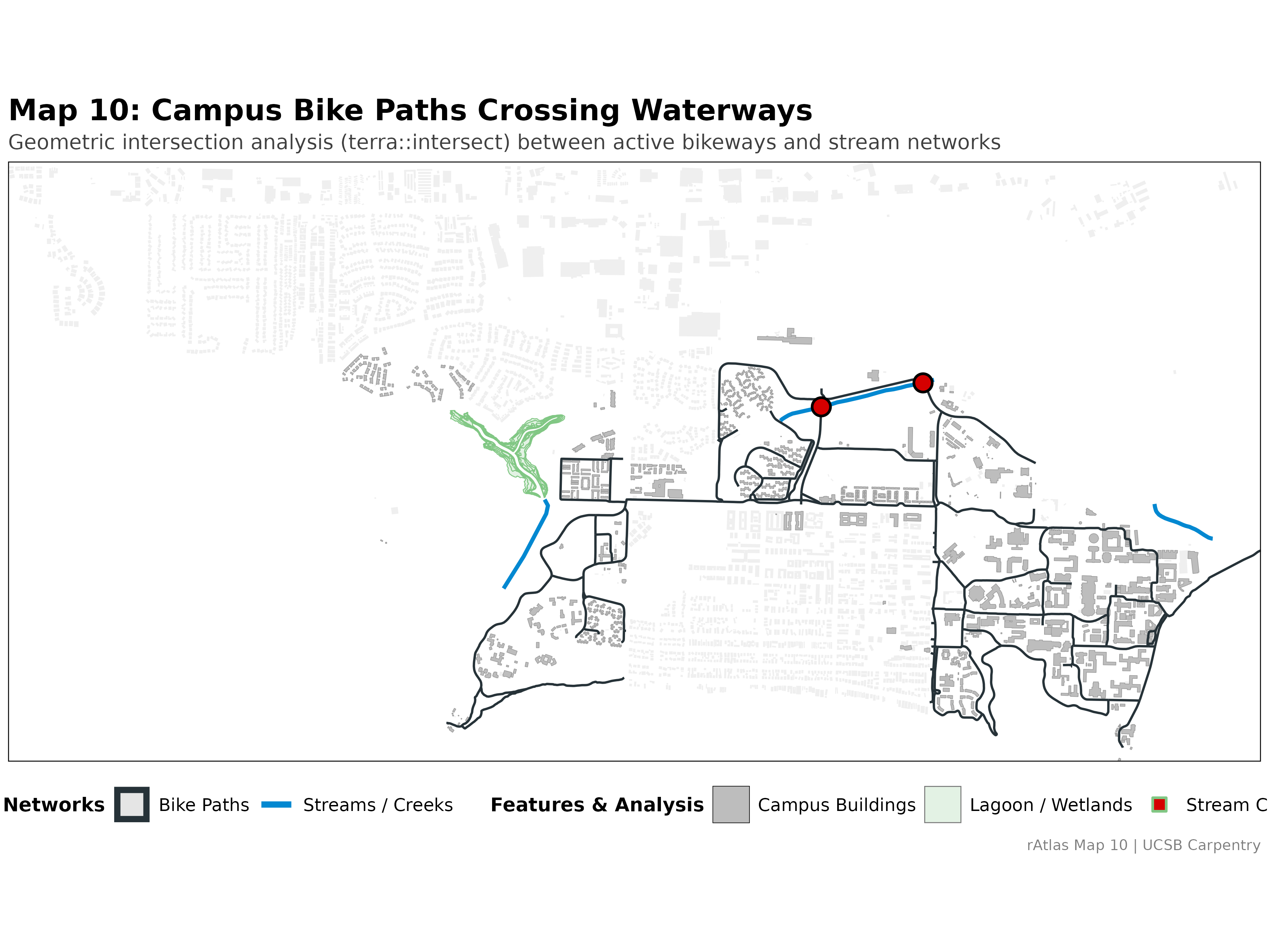
Vector intersection analysis mapping bike path stream crossings.
Map 10.5: Missing NCOS Trail
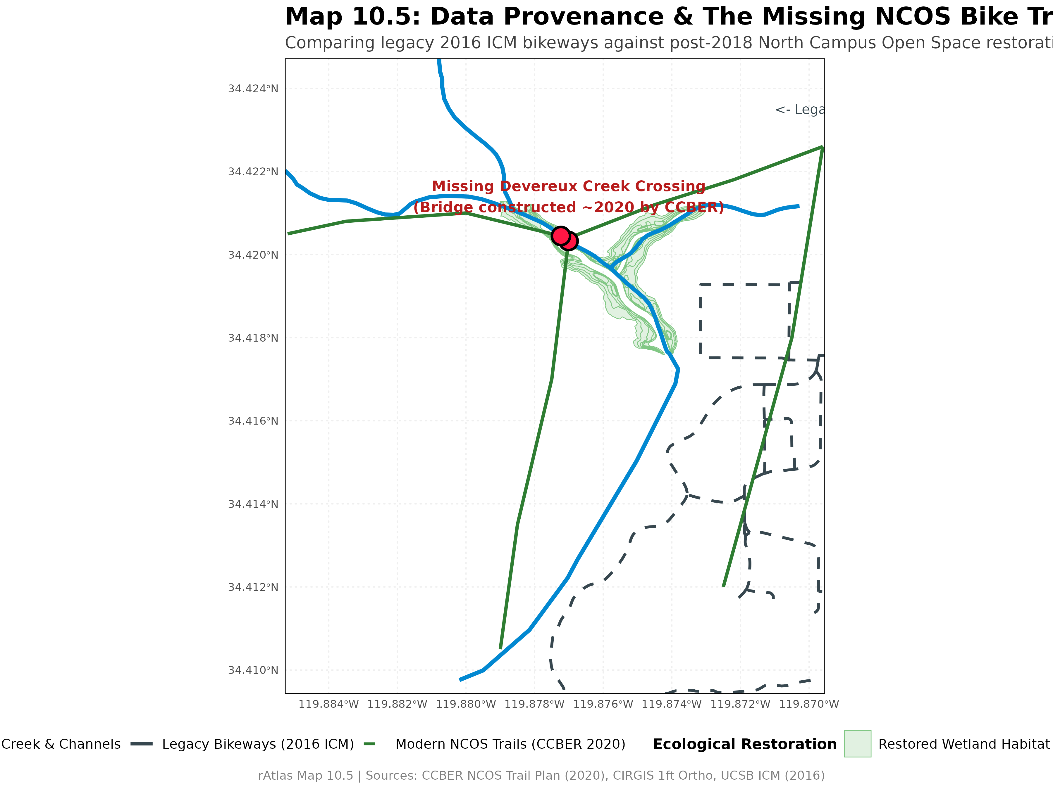
Investigating temporal blind spots in campus bikeway data.
Map 11: Dibblee Geology
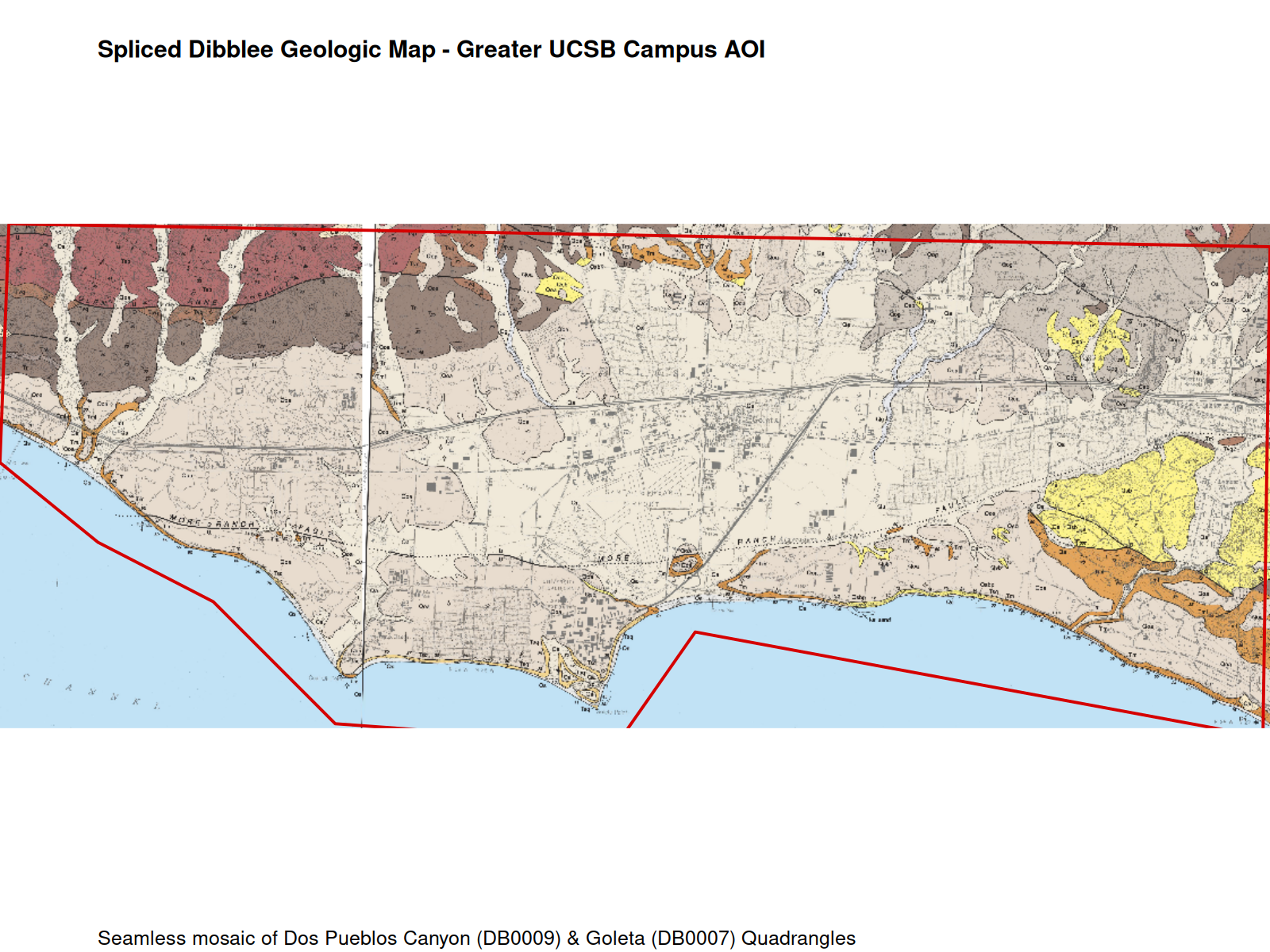
Rectified and cropped historic geologic quadrangle map.
Map 12: NDVI Phenology Stack
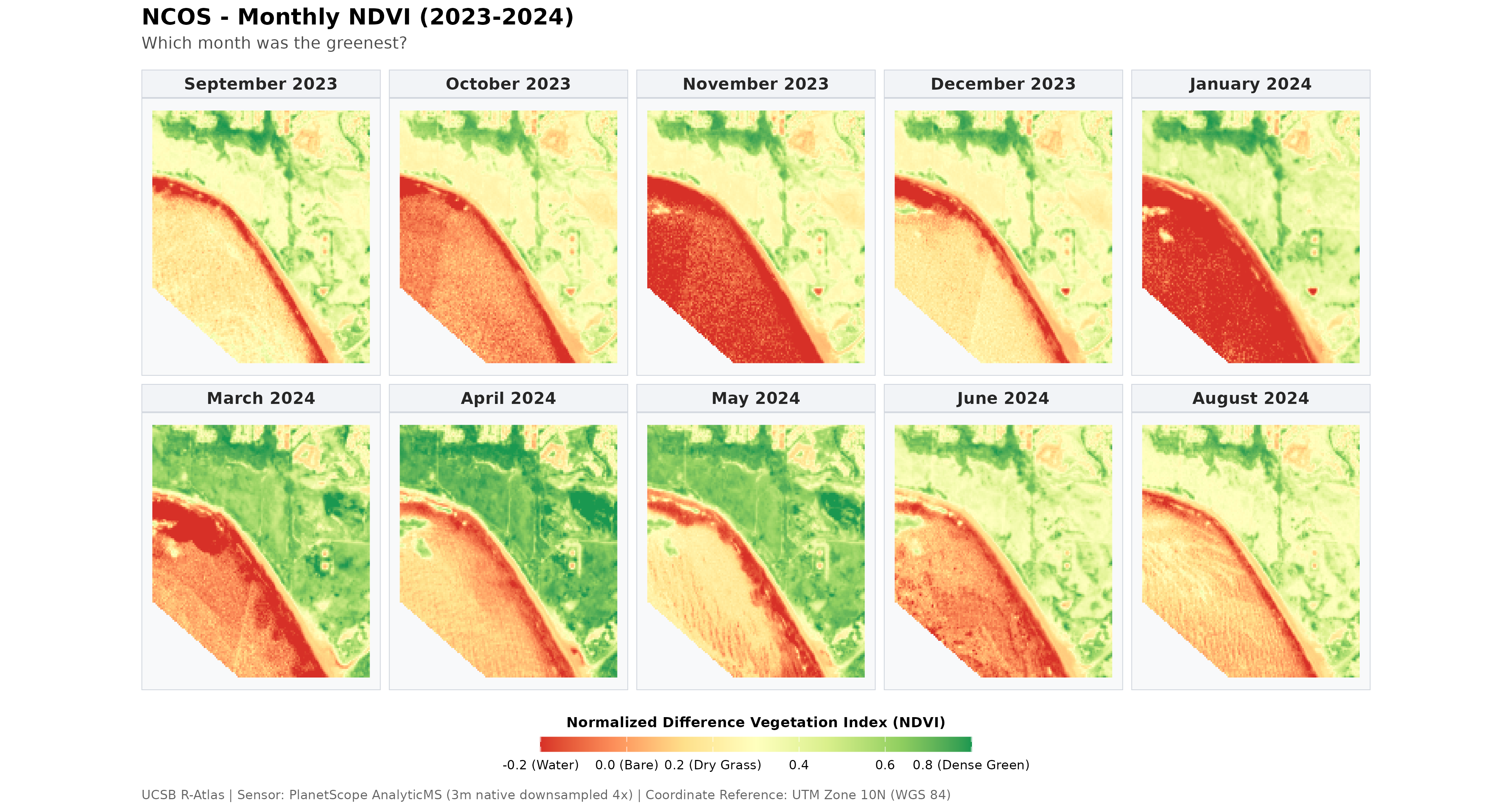
Annual vegetation index dynamics from satellite time series.